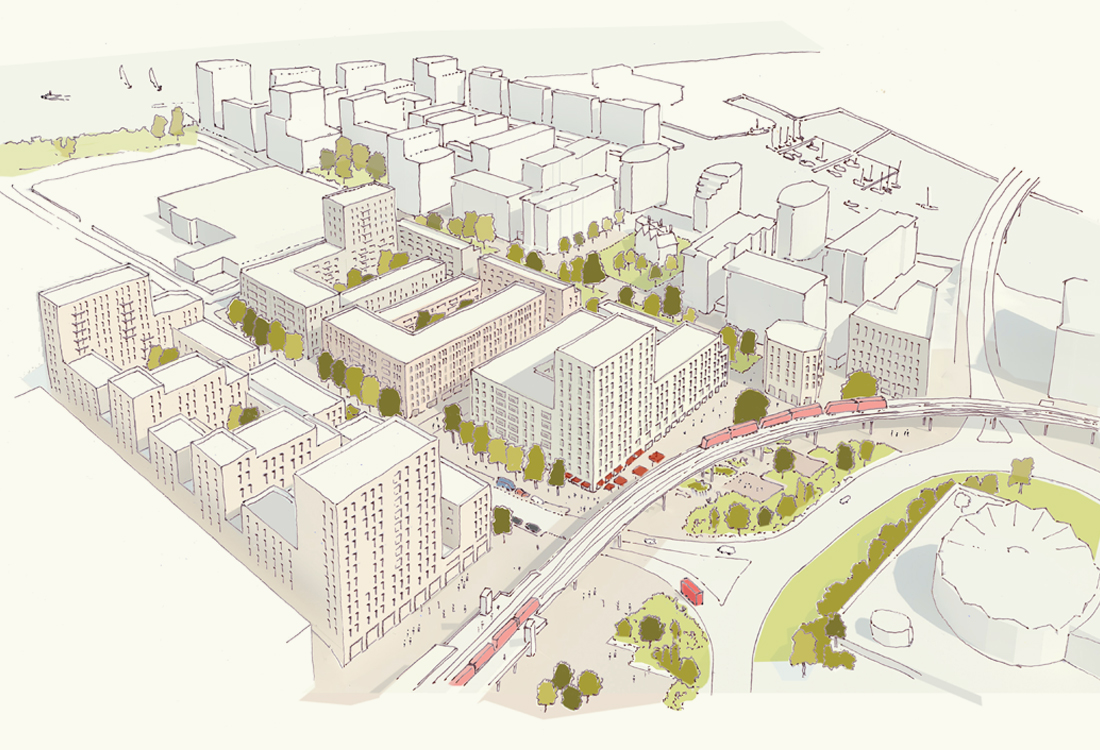
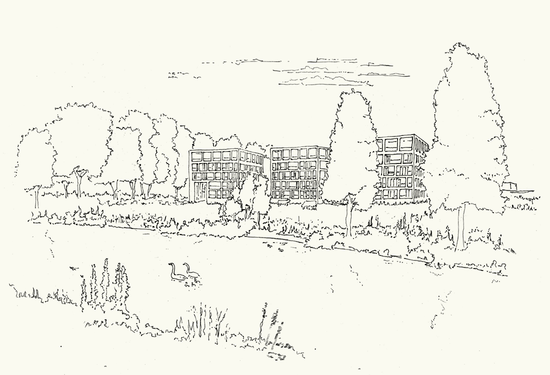
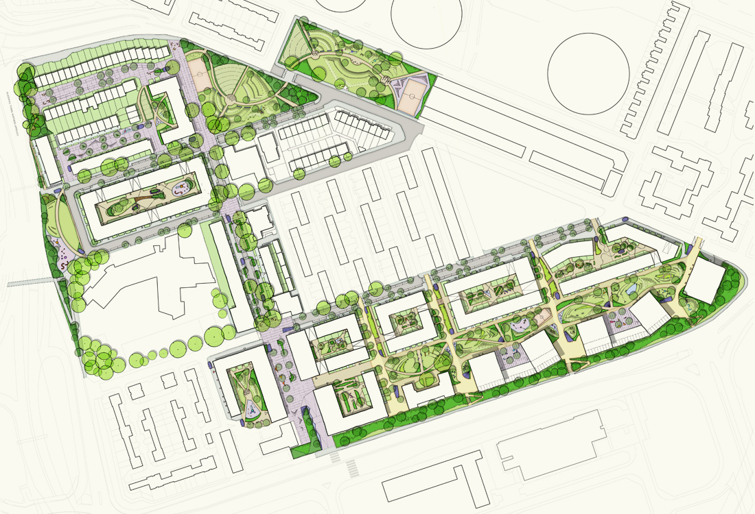
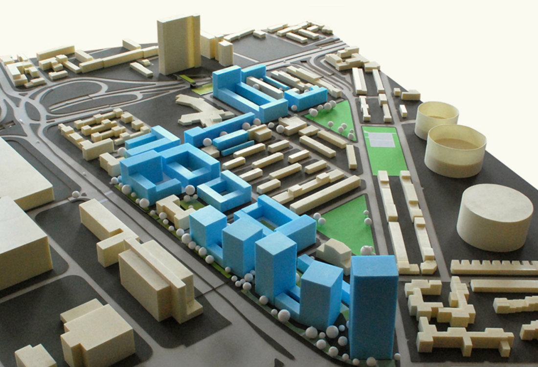
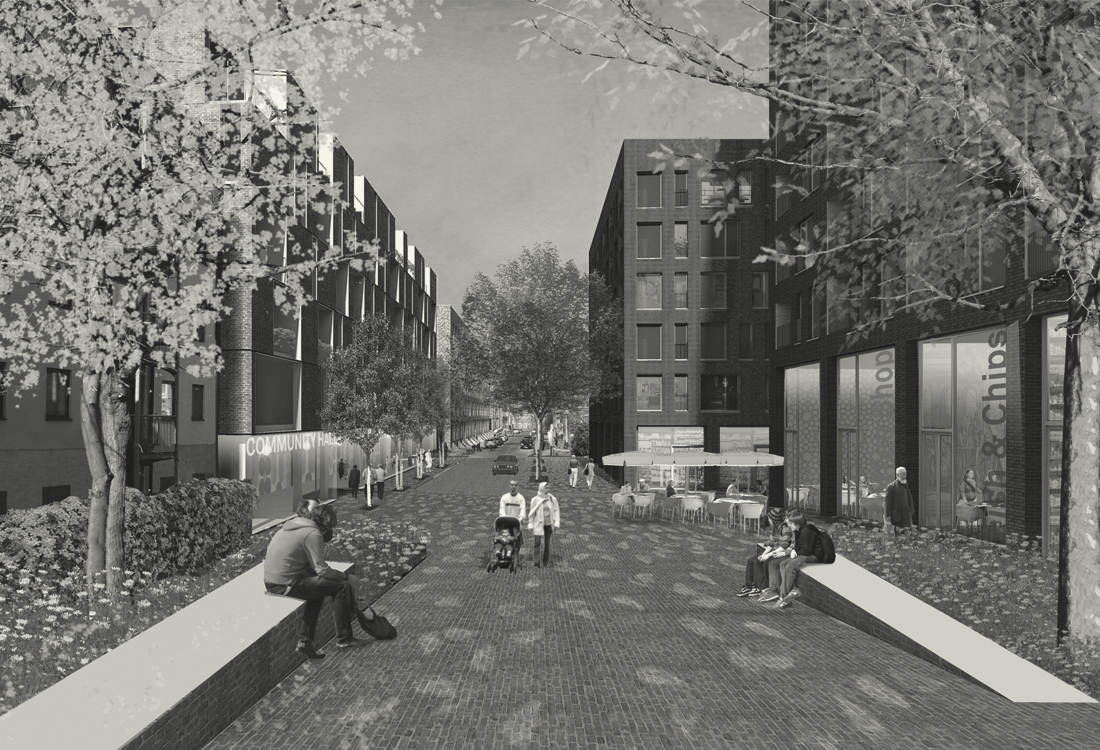
URBAN planning/catford island
Re-connecting an urban island to the surrounding community
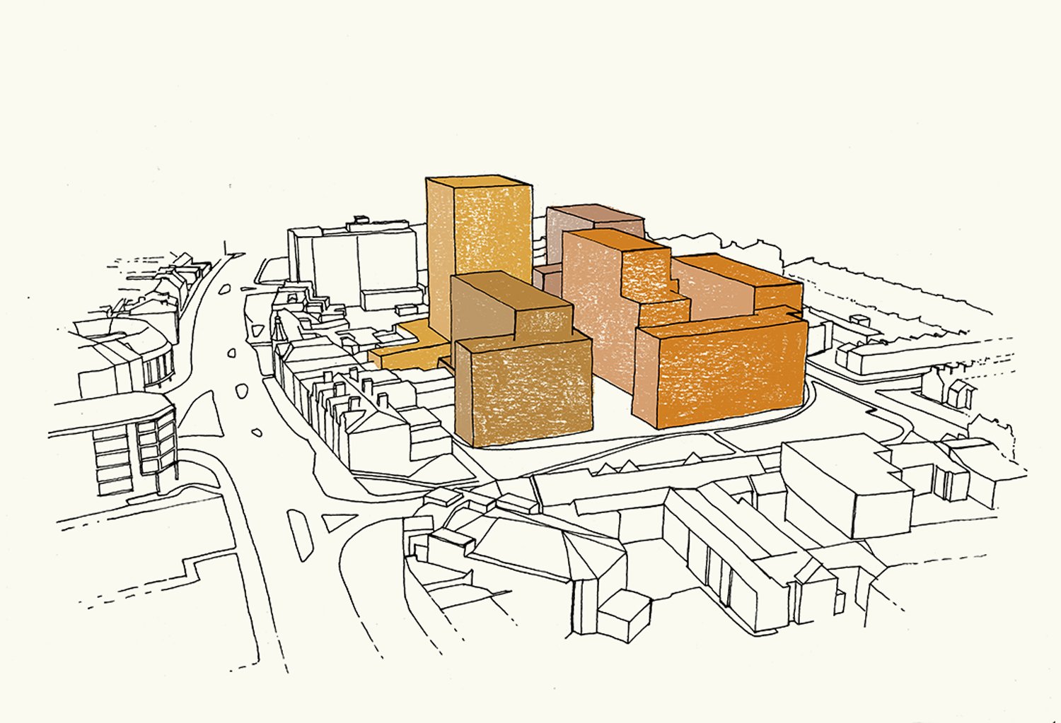
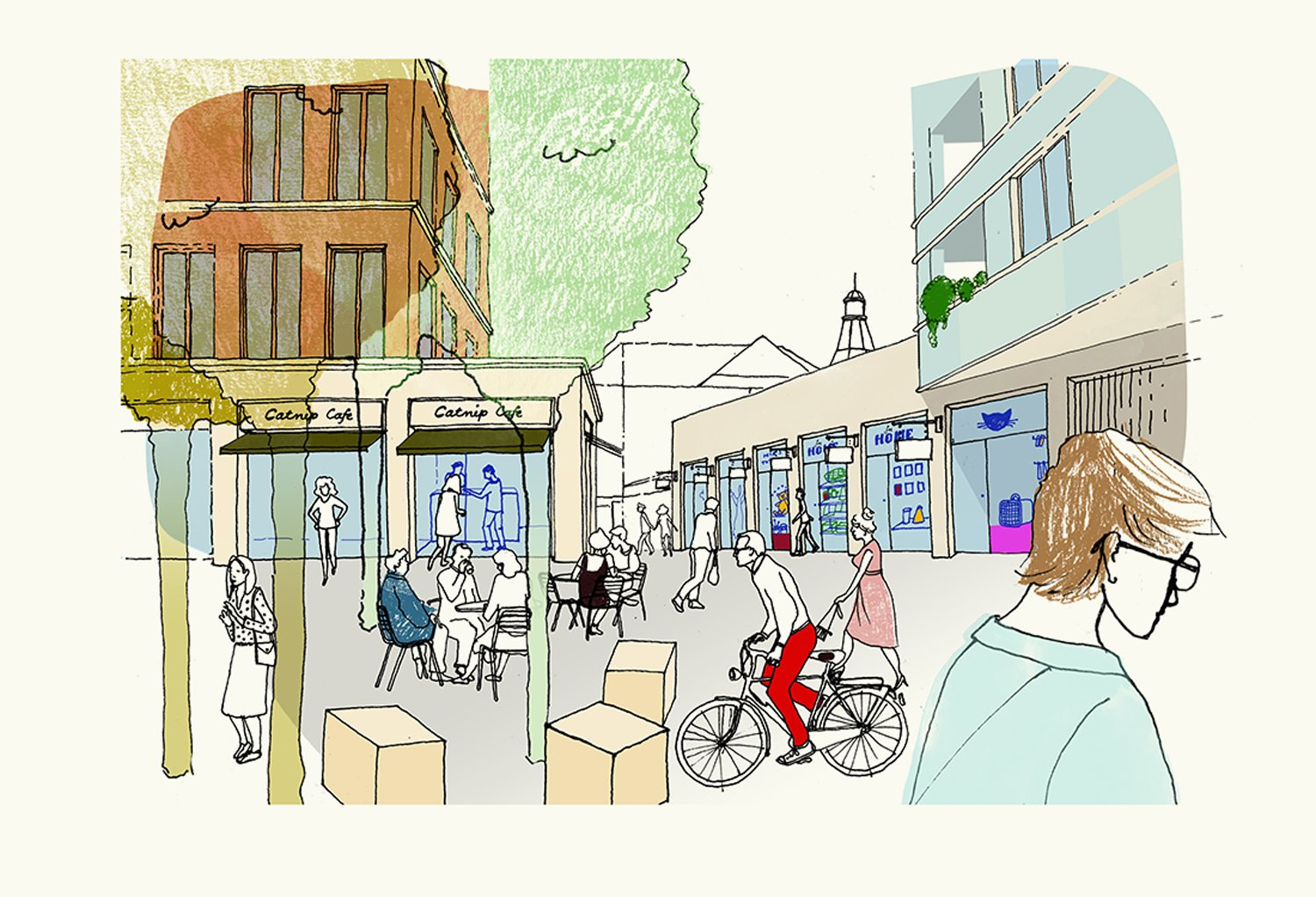
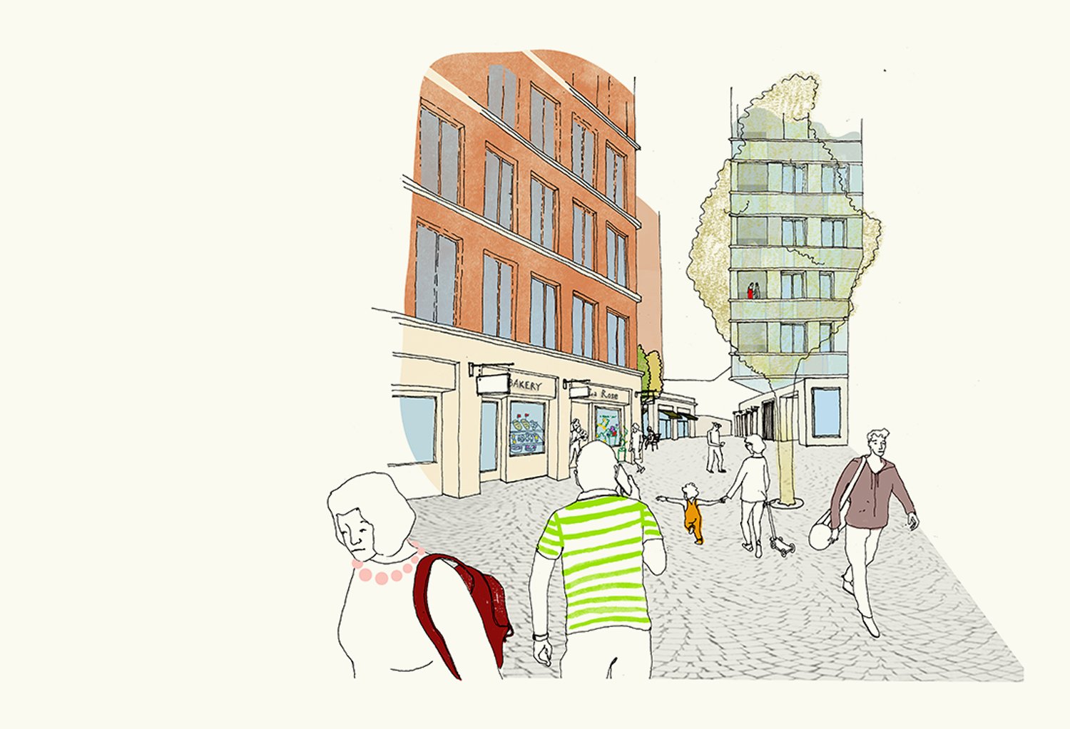
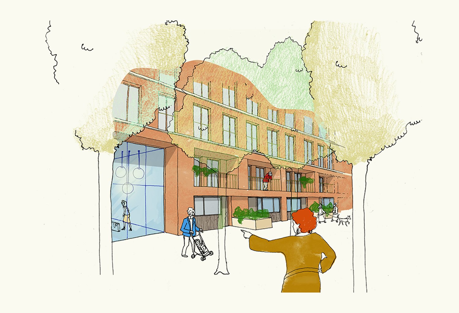
The Church Commissioners of England invited Countryside to participate in a design competition to a create a vision for a significant island site in Catford, in the London Borough of Lewisham. Urban Habitat Studio developed proposals to achieve the high density development aspirations and create a place making vision for the site. The proposals included a series of public spaces, with a commercial corridor and anchor store to make a new destination off the high street. A north-south oriented garden square is situated at the centre of the development with an intensive tree grove at its heart creating a unique identity for the community.The Church Commissioners of England invited Countryside to participate in a design competition to a create a vision for a significant island site in Catford, in the London Borough of Lewisham. Urban Habitat Studio developed proposals to achieve the high density development aspirations and create a place making vision for the site. The proposals included a series of public spaces, with a commercial corridor and anchor store to make a new destination off the high street. A north-south oriented garden square is situated at the centre of the development with an intensive tree grove at its heart creating a unique identity for the community.
URBAN planning/homerton yard
A masterplan vision for a new mixed-use destination in east London


The Homerton Yard masterplan vision and capacity study produced for Countryside, supported a business plan for the redevelopment of this brownfield site in east London. Located next to Homerton overground station, this car-free mixed-use development included 5,500sqm of commercial uses accessed from a new industrial yard creating a new route to the overground station. The high density proposal included consolidating a large number of private ownship parcels into a single vision. The development includes a variety of building typologies to frame the surrounding streetscape, podium landscape and 3 towers offset to provide long views across London.
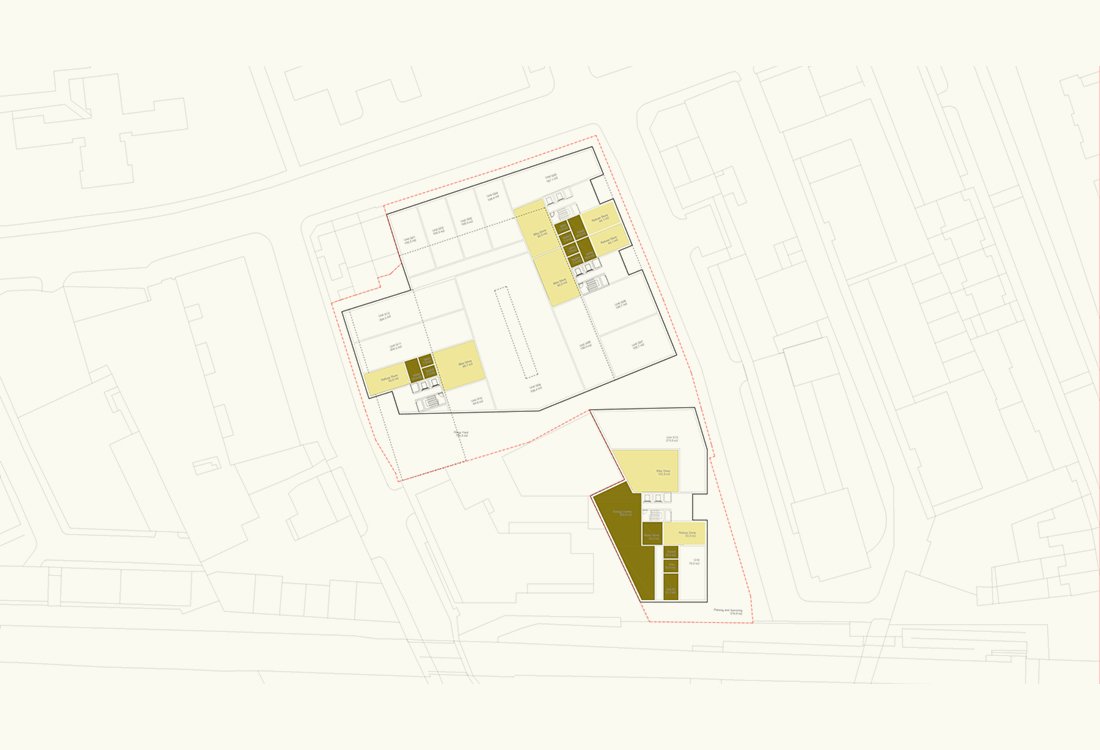
URBAN planning/ROYAL ALBERT WHARF
A masterplan that re-connects the Royal Docks with the city
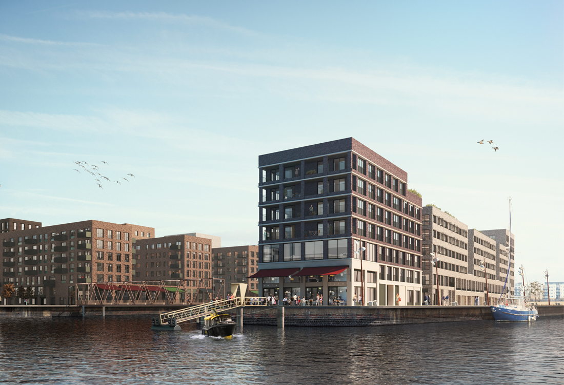
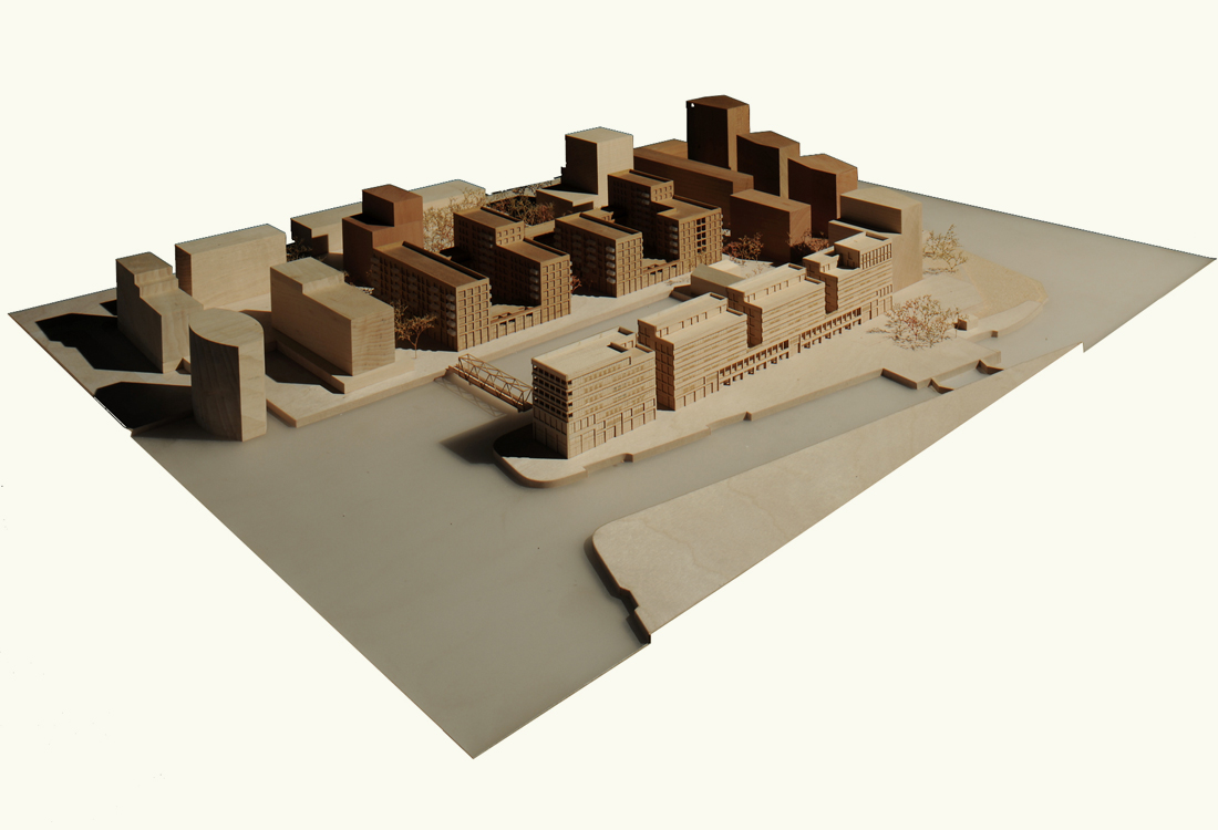
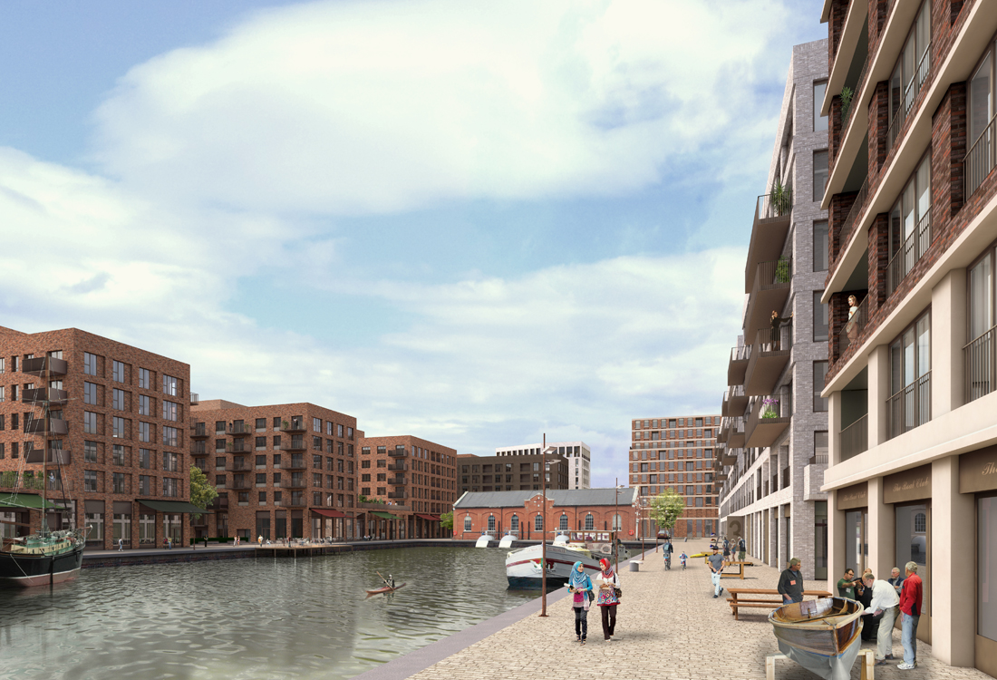
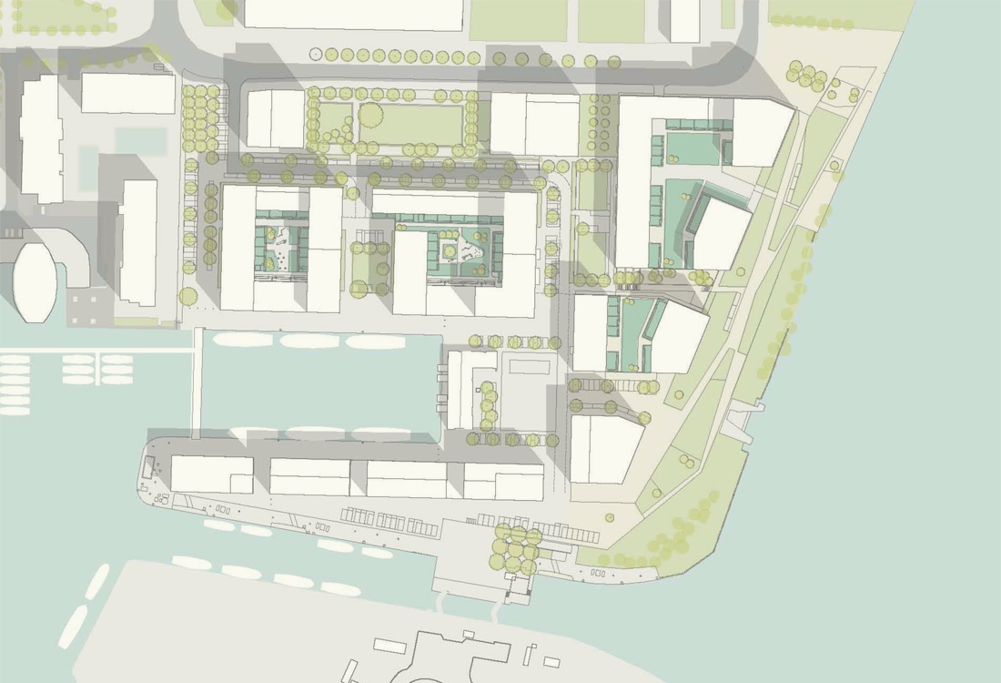
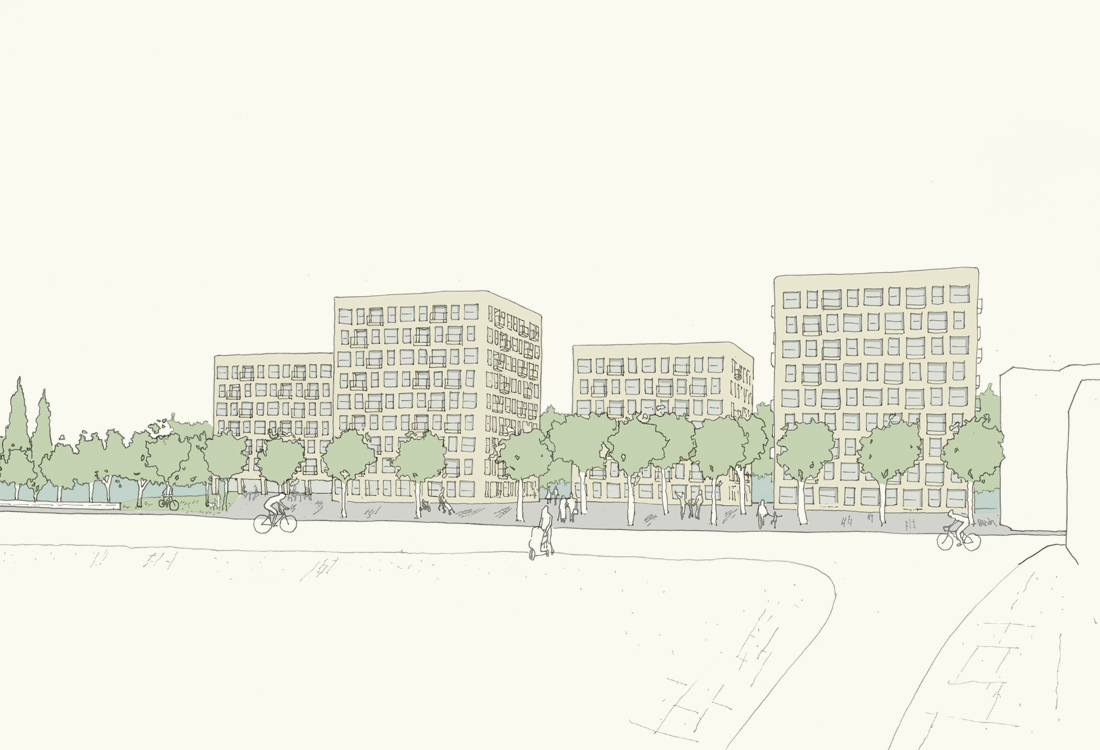
The Royal Albert Wharf masterplan called for a strong placemaking vision, to define a new mixed-use community of over 1,500 new homes, along with workplace and retail that makes the eastern-end of the Royal Docks a place in its own right; where the docks meet the Thames. The masterplan by Maccreanor Lavington sets-out urban design principles that considers the wider area, including the adjaent Gallions Quarter site, to create a coherent and new residential area reconnecting the northern edge of the dockside to the city of London. The masterplan was designed around three distinct landscape spaces, the intertidal riverside, the historic dockside, and protected residential garden squares.
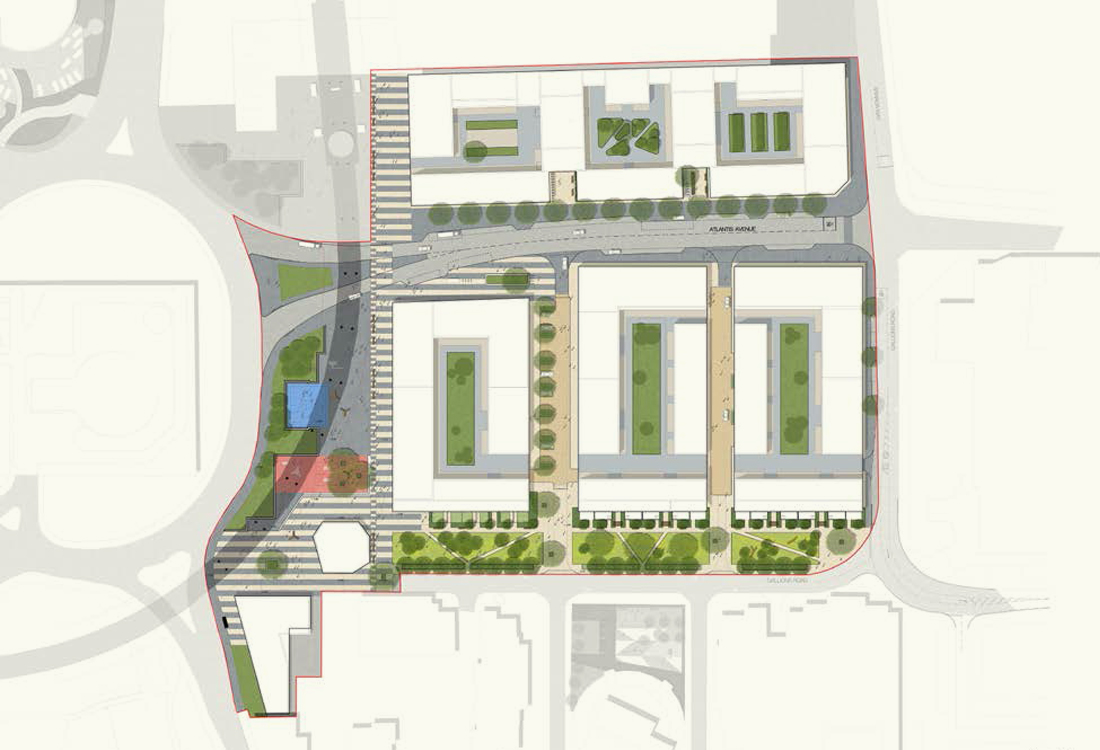
URBAN planning/ALBANY RIVERSIDE
Waterfront Villas in Watermans Park Brentford
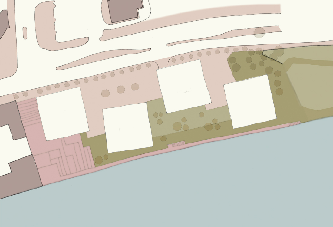
This competition scheme by Maccreanor Lavington for the re-development of the Watermans Art Centre site in Brentford proposes extension of Watermans Park, creating a shared landscape for the development. New residential villas are set into a fully-accessible terraced landscape with public uses at the ground floor including a gym and cafe. The urban design strategy to 'extend the park' aimed to bring the site closer to the Brentford High Street and reconnect this site into the wider context.
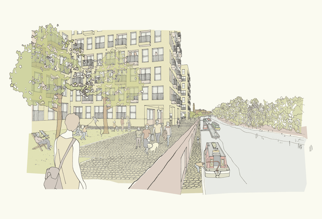
URBAN planning/BRENTFORD WATERSIDE
A vision to reconnect the high street with the River Brent through the reinstatement of historic industrial yards

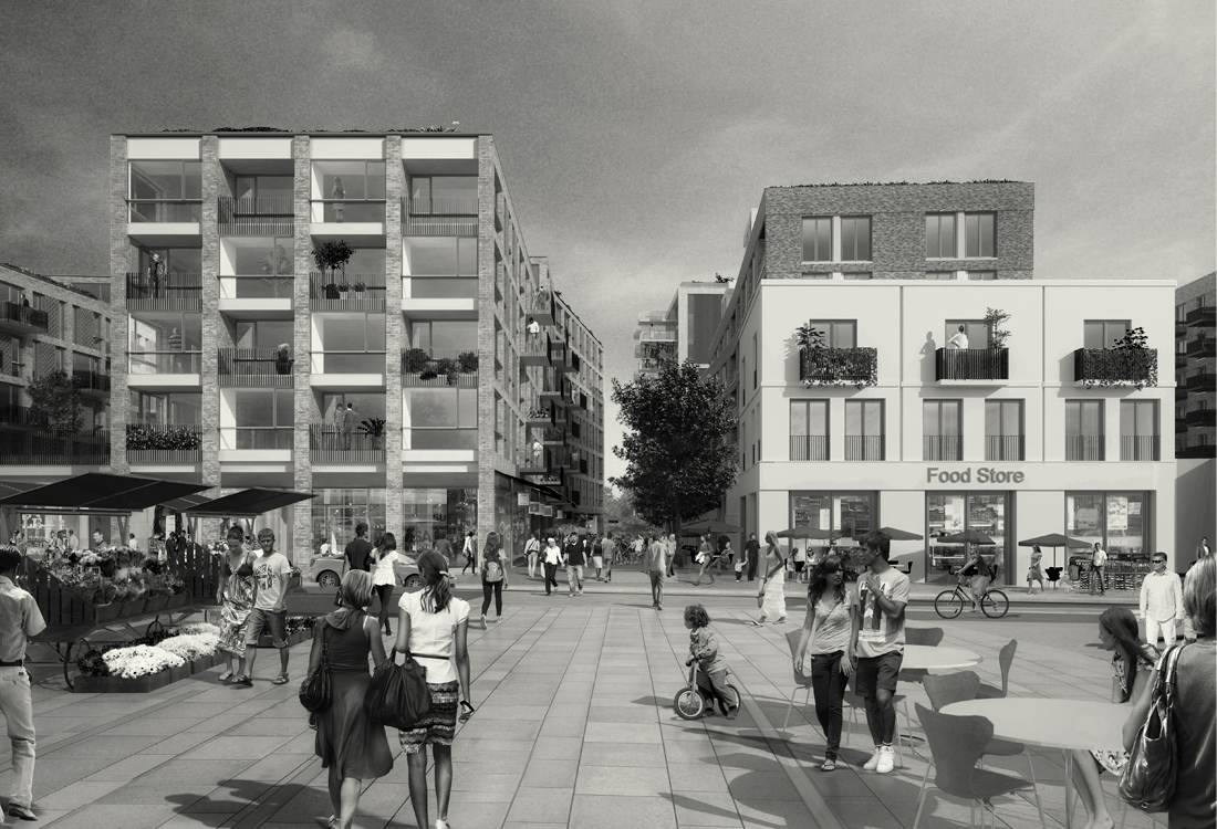
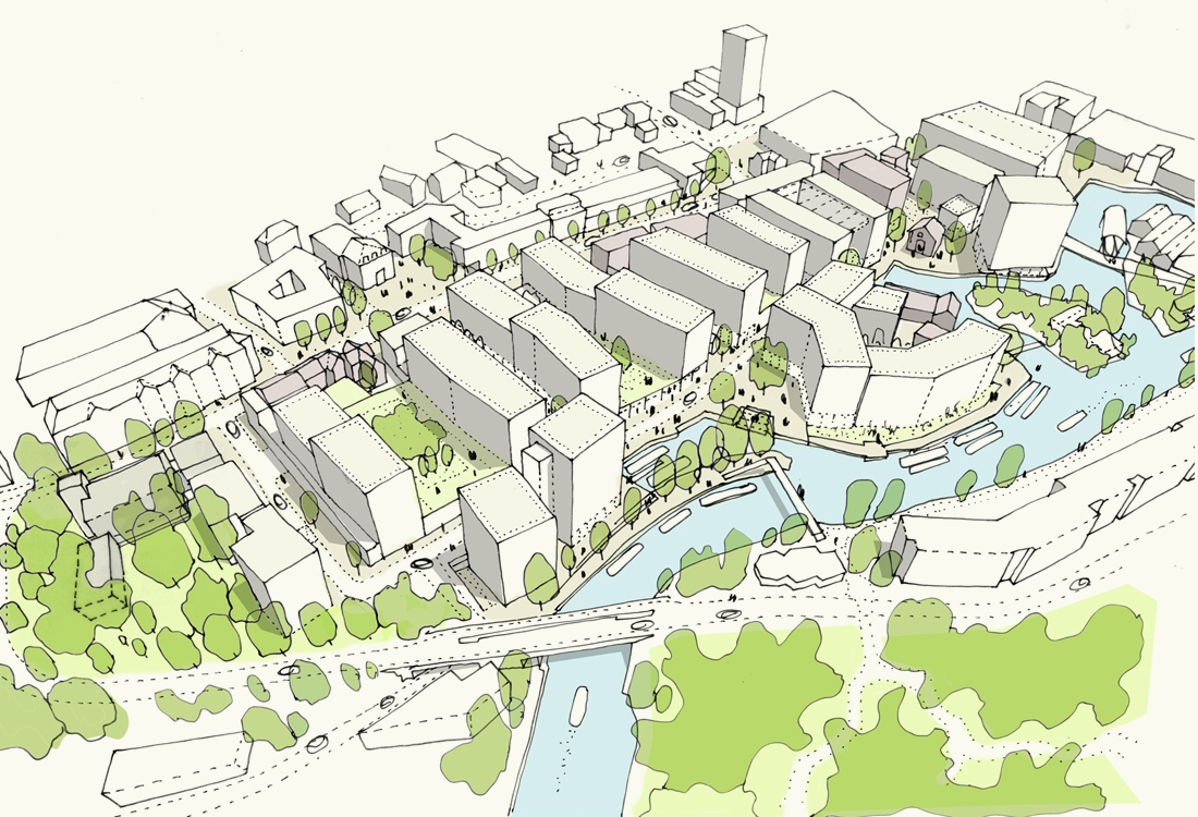
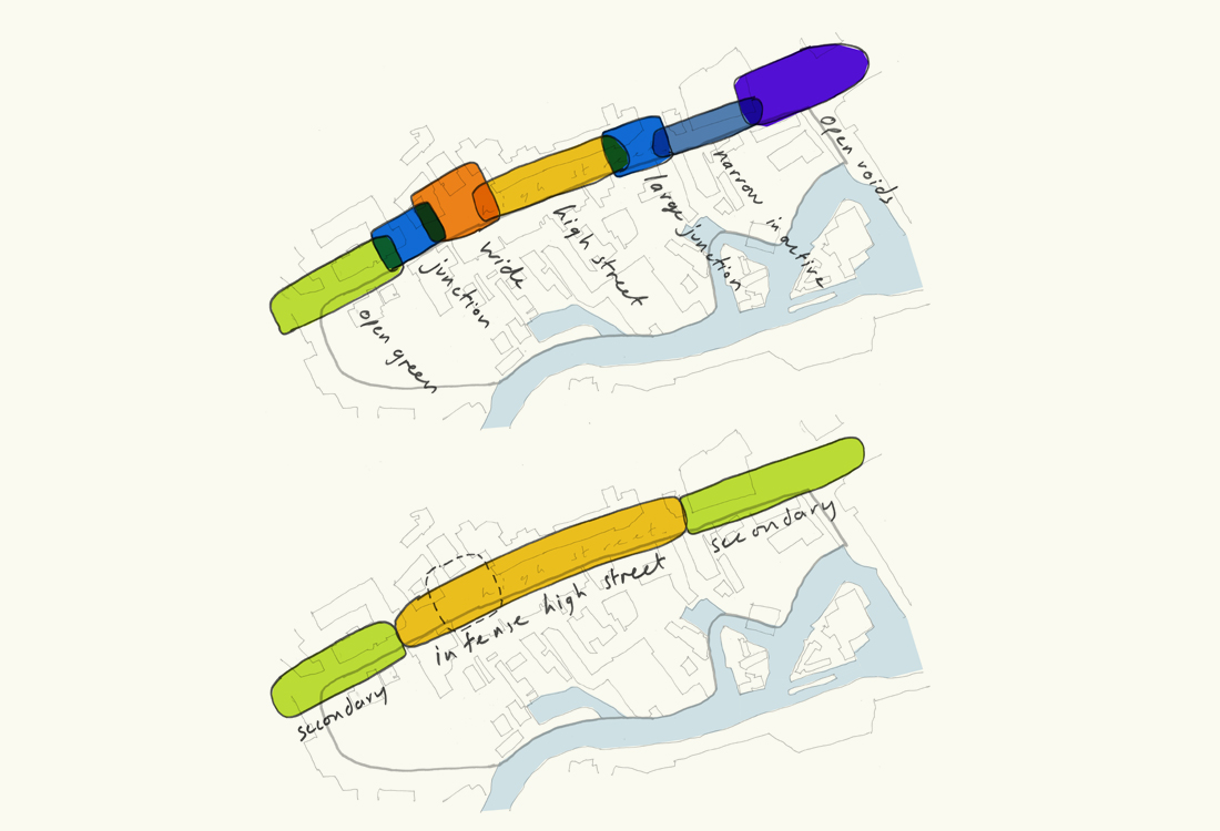
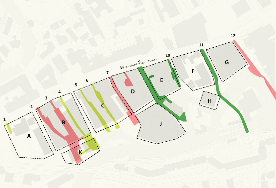
The Brentford Waterside masterplan was developed by a collaborative team of architects, including Maccreanor Lavington, AHMM and Glenn Howells. The masterplan is bounded by Brentford High Street to the north and and the River Brent to the south, the re-connection of these two important public spaces was central to the masterplan vision and achieved by reinstating historic yards and retaining historic buildings to anchor the masterplan in the industrial history of the area. Our design focussed on phase 1 that included a new anchor opposite the old town hall with a residential block set back from the high street.
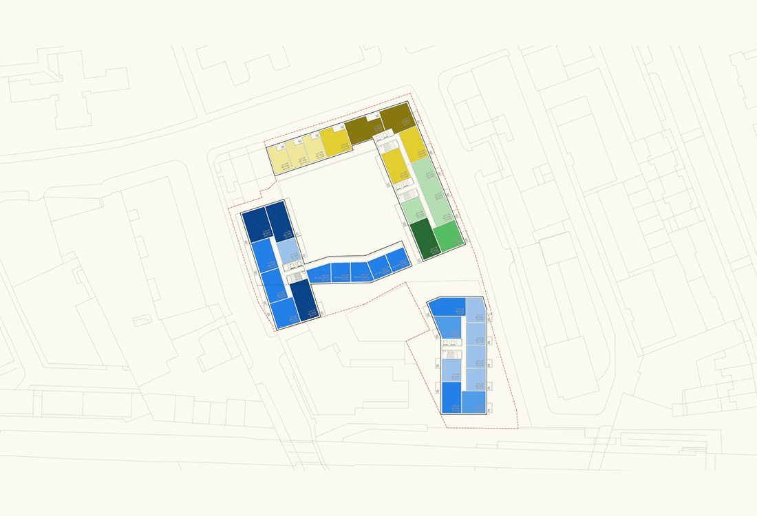
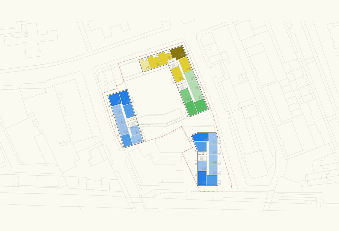
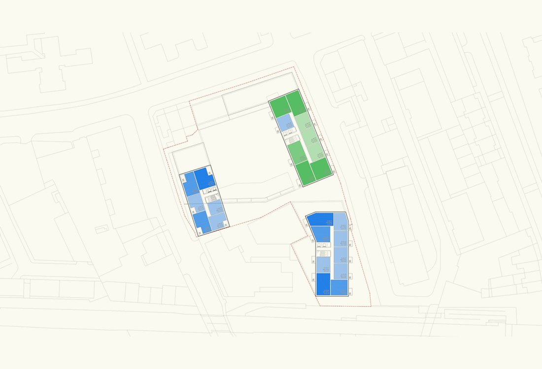
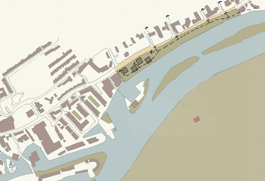
URBAN planning/GALLIONS QUARTER
A new local centre where the Royal Docks meet the Thames
The Gallions Quarter masterplan has been designed in tandem with the adjacent Royal Albert Wharf masterplan, creating a new residential quarter with its own unique identity. The masterplan was developed around 3 landscape spaces, an urban park under the DLR viaduct with local shops and services, a boulevard of mansion blocks, and a linear green connecting the masterplan to the wider area. The public spaces are complemented by a traditional streetscape maximising private front doors and on street parking, to create a vibrant and active community.
URBAN planning/OSNEY LANE
A vision, capacity and constraints study for a riverside development in Oxford
The study was prepared in response to Oxford City Council’s request for development partners for the site. The masterplan study involved comprehensive analysis of site information as well as preparation of a design response to both the SDP illustrative masterplan and development of a new vision and masterplan proposals for the site. The proposals explored strategies to address flood mitigation through the integration of sunken courtyards which would assist with flood attenuation and drainage. The new villas are set within a varied landscape including flood zones and an active streetscape connecting the site to the riverfront.
URBAN planning/ABERFELDY NEW VILLAGE
A development framework to provide high quality affordable housing for Poplar HARCA
Aberfeldy New Village masterplan was co-authored by Maccreanor Lavington and Casey Fierro Architects, creating a 12 year development framework for the site. The proposals transform the area by locating high quality public open space at its centre framed by 1153 new homes creating active and overlooked routes through the community, protected from the harsh environment of the adjacent motorways. The masterplan provided a placemaking vision centred around a linear green space overlooked by ground floor homes with front doors and apartments above. Proposals included design guidelines and paramater plans to allow for a diverse design team.
URBAN planning/BRENTFORD LOCK WEST PHASE 3
Re-visioning of a masterplan to include new education, infrastructure, workspace, housing & public realm
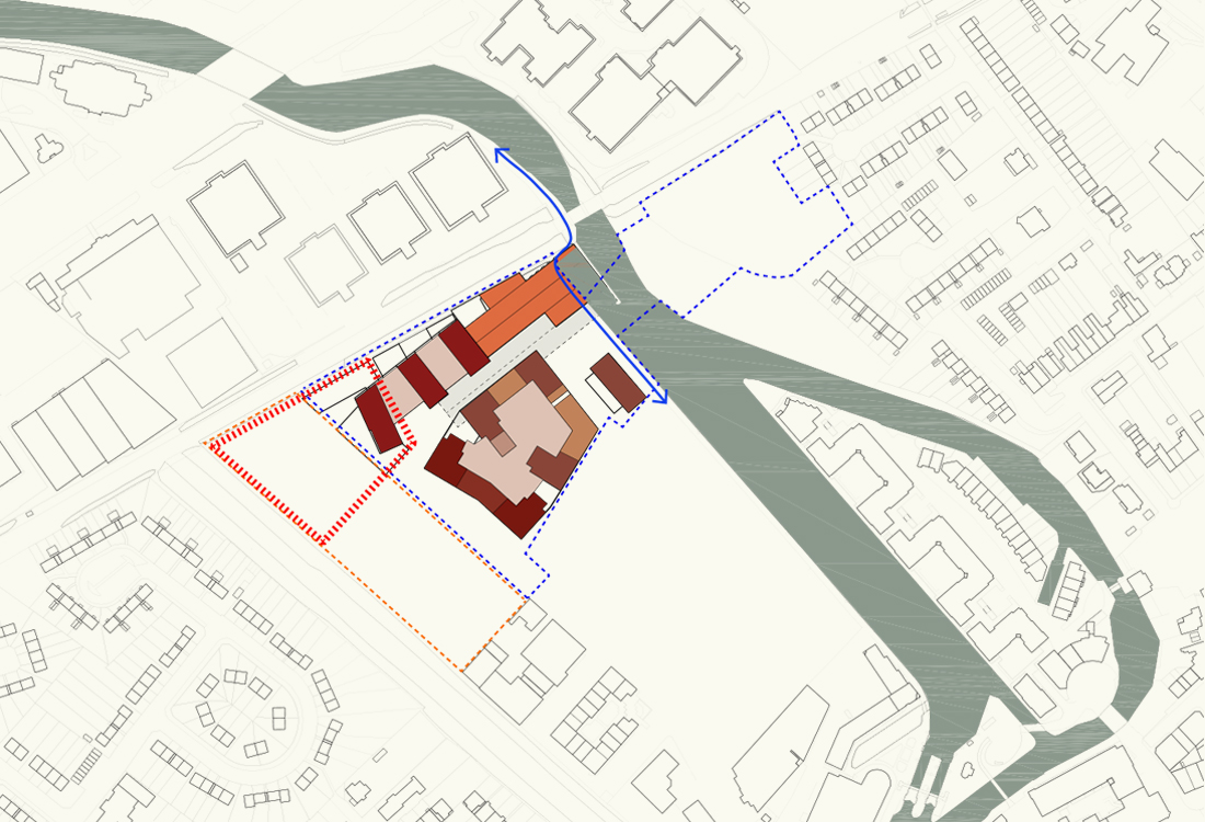
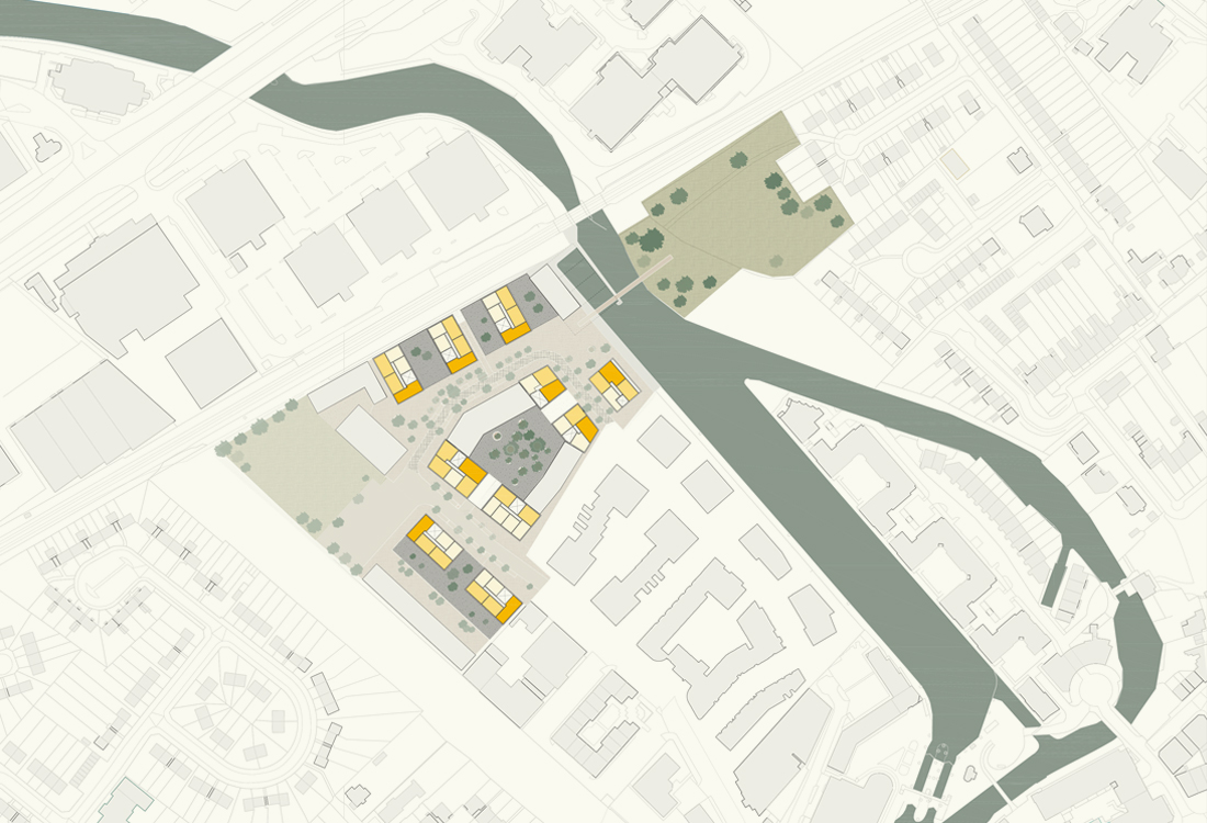
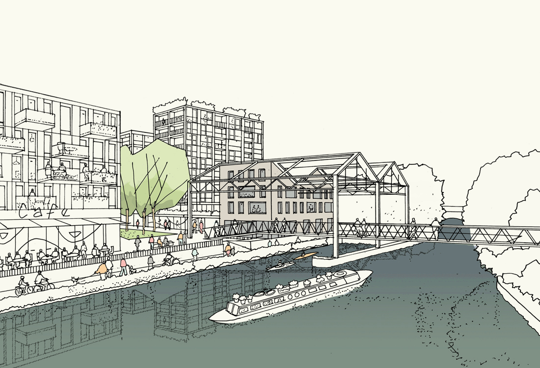

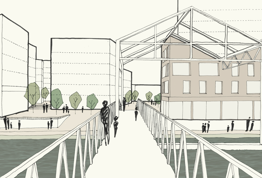
This commission involved re-visioning the Brentford Lock West masterplan to include a large adjacent brownfield site. The study undertaken by Maccreanor Lavington explored opportunities to provide community facilities, including a new community hall and two-form entry school at its heart, along with additional mixed tenure housing. The study considered existing historic industrial buildings on the site, including strategies to include them within the masterplan, and imporove connections to Brentford train station by way of a new footbridge.
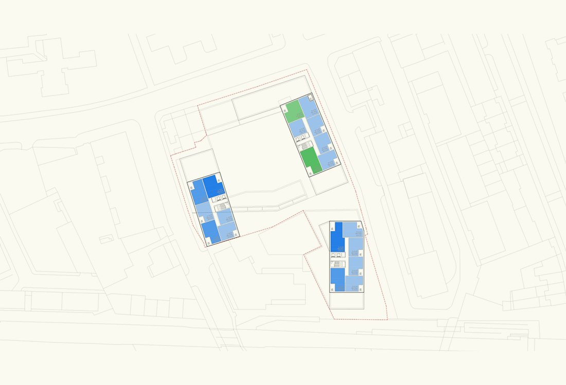
URBAN planning/ALBERT BASIN SCOPING STUDY
A study prepared for the GLA, exploring potential uses for vacant sites in London’s Royal Docks
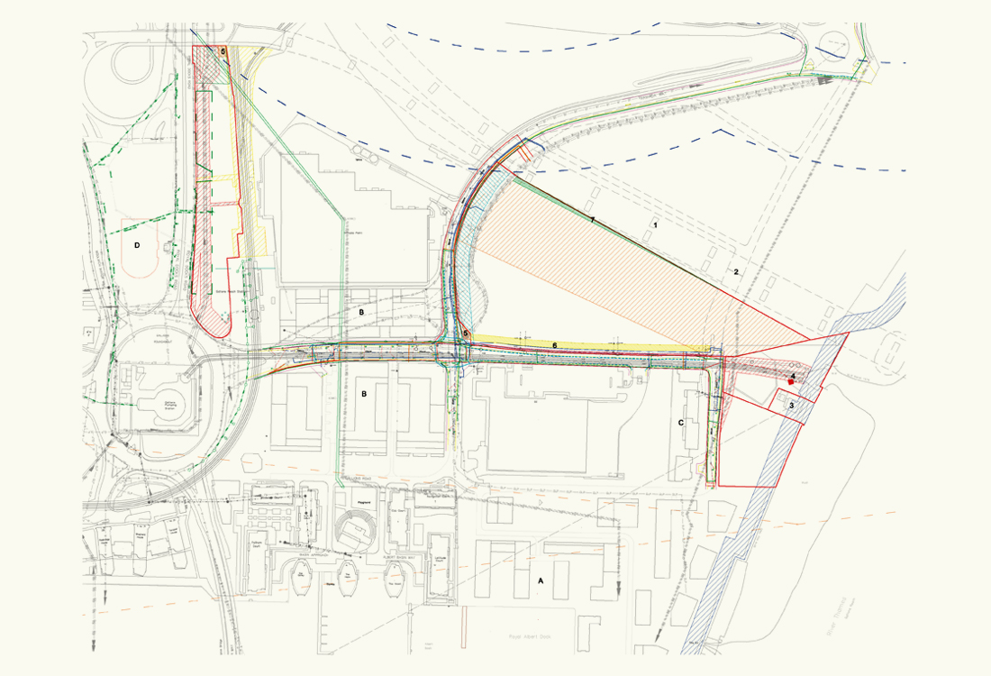
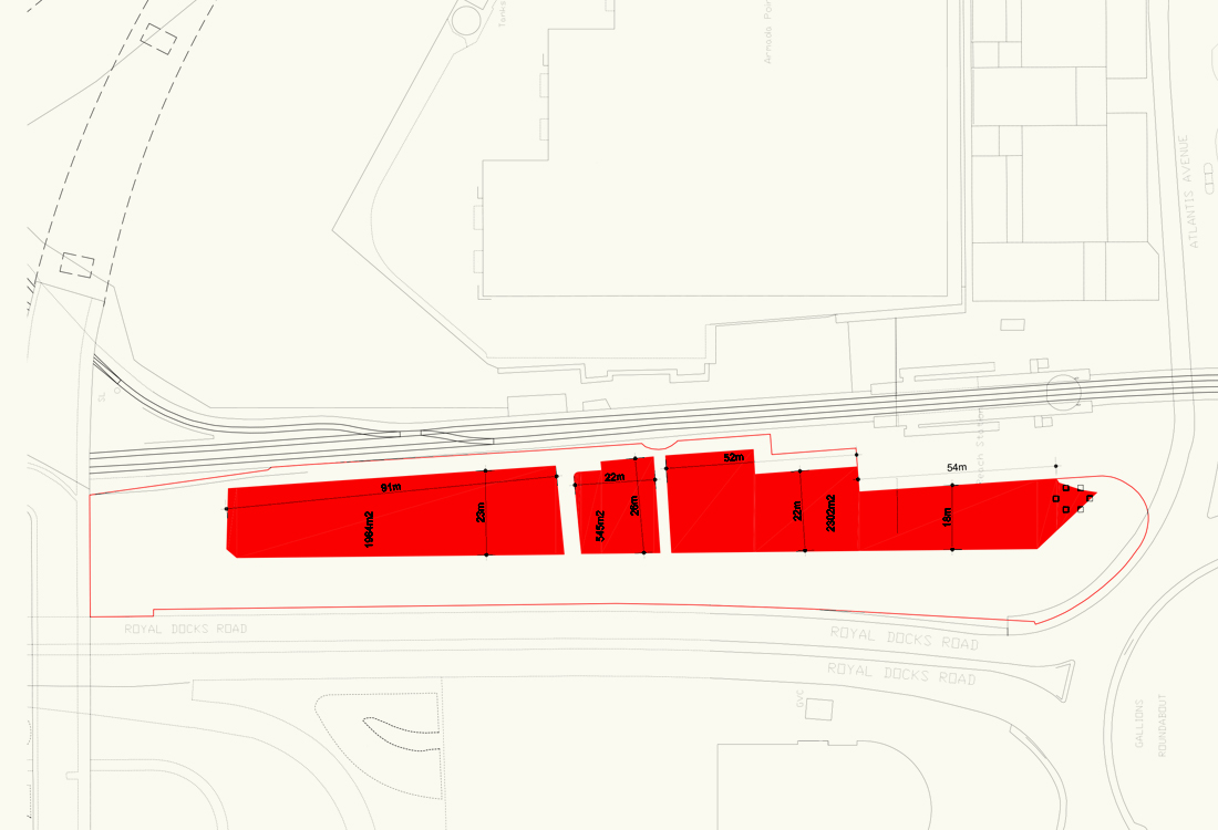
Commissioned by the GLA, this study examines the constraints and capacity for development on three vacant sites whichsit within the Royal Albert Basin area. The study gives an overview of the myriad of physical, legal and environmental constraints imposed on the three sites. Initial briefs for potential uses have been developed, including development parameters, potential site layouts and an estimated quantum of development indicated for each of the sites. The study helps facilitate an informed and coordinated decision making on the future of the sites.